GIS resume skills should connect a geographic question to an actual dataset, processing step, quality check and map or analysis product. Relevant capabilities may include data editing, layer management, coordinate reference systems, geometry validation, metadata, geocoding, spatial joins, map design and GIS database maintenance. A software brand alone proves little. Specify whether the work was coursework, a personal project, internship or production assignment, and state what parts you completed. Geographic maps can look convincing even when the underlying data are misaligned or outdated. The examples below are hypothetical unless a stated source explains an occupational duty. Replace sample duties with your own verified work; no employer can guarantee interviews or automated-screening outcomes from a skill keyword. Always read the particular vacancy and any relevant state requirements before representing a qualification.
Separate relevant skill labels from real responsibility
O*NET describes GIS technologists and technicians as supporting geographic databases, producing layers and maps, checking source quality, and helping users. Not every role requires application development or remote sensing, and titles vary widely. A field mapping technician’s GPS collection differs from a spatial analyst’s database operations. The best resume examples show the candidate’s place in that workflow. If you only visualized data, do not claim to have surveyed land or designed a geospatial database. Read the vacancy for expected software, data formats and project scale.
Coordinate reference systems are a useful test of real competence. If you transformed features between coordinate systems, state that and explain how you checked results. Merely changing a display setting is not necessarily a validated transformation. Geometry QA may involve spotting duplicates, gaps, self-intersections, mismatched attribute records or invalid shapes. Describe the specific check and whether errors were corrected, logged or referred to the data owner. Do not claim that a map meets a surveying accuracy standard unless it actually does.
Turn technical know-how into verifiable evidence
Spatial analysis belongs on a resume when the method is clear: buffer creation, point-in-polygon selection, network analysis, proximity comparison, raster processing or a spatial join. State which were completed and why. For example, joining transit stop points with neighborhood boundaries can be a coursework demonstration, not a proof of access planning or public policy impact. When using public data, check publication date and licensing conditions and cite the source in a portfolio. Avoid presenting a map as a definitive answer where input coverage is incomplete.
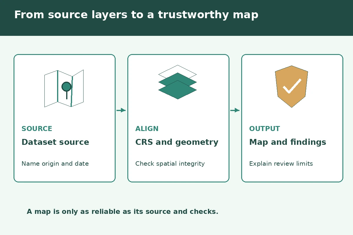
Choose one accessible, nonconfidential project to show depth rather than displaying a folder of exported maps. A useful project note includes geographic question, source and date, projection or CRS, processing steps, checks, output, and limitations. A hiring manager should be able to reproduce your reasoning from the description. An animated map with no provenance is weaker proof than a modest static map whose dataset and validation are clear. Never reveal protected addresses, sensitive infrastructure details or internal employer datasets without permission.
Rewrite an overstated bullet into a truthful example
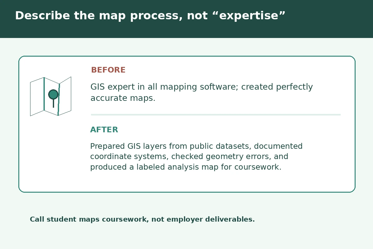
Hypothetical GIS student bullet: “Cleaned public trail-network layers, documented each source and coordinate system, checked invalid geometries, and produced a clearly labeled access map for a capstone project.” A different candidate might accurately report maintaining parcel attributes under supervision, with quality flags referred to the database owner. Do not turn a class map into a municipal government project, state that you collected field surveys when you imported existing coordinates, or invent precision measurements.
An effective bullet follows a verifiable sequence: identify the material or case, describe the part you personally completed, name a meaningful review or exception check, and explain the next approved handoff. You do not need an impressive percentage to be useful. If a manager could not verify the action, change the sentence before submitting it. The sample sentences are illustrations, not statements about an actual applicant.
| Claim to check | Evidence that helps | Risky wording to avoid |
|---|---|---|
| Role and scope | Specific task, level and reviewer | Claiming full team authority |
| Tools and methods | Program used for a named task | Listing tools only from a tutorial |
| Credentials | Exact current issuing status | Confusing coursework with a license |
| Results | Record-backed, shareable outcome | Invented percentages or promises |
Use credentials and role limits precisely
Software proficiency should be specific. GIS desktop editing, geodatabase maintenance, Python scripts, web mapping and spatial SQL are separate capabilities. Put the actual versions or environments if they matter and you know them. A tutorial completed once may support “introductory experience” but not expert proficiency. If a project used code copied from a course, describe what you adapted and tested, not authorship of the entire system. Mention credentials only when a recognized organization issued them and the status is correct.
Organize a short skills line around “Spatial data,” “Analysis and quality,” and “Mapping and communication.” Then link the most important skill to a concrete project or job bullet. For an entry-level GIS position, projects should make their school or volunteer status clear. An experienced GIS technician can prioritize production data maintenance and exception resolution. The reader should understand what question you addressed and why your output could be trusted within its limits—not just see ten software logos.
Remove the claims that would fail a reference check
The classic GIS resume error is listing many tools without one reproducible example. Others include mixing geocoding and surveying, claiming “accurate data” without a source check, or presenting an appealing map that hides a CRS mismatch. Do not claim to own a dataset you downloaded. Avoid absolute phrases such as “error-free map” or “all data verified” when you checked only some fields. Show a bounded quality method and report known missing values or unavailable ground truth.
Review the resume as an occupational supervisor would
Open every shared portfolio link without logging into your own account and check that legends, units, scale, credit and limitations remain readable. Confirm source names and dates, project ownership, software terminology and actual review steps. If you mention Python, SQL or custom tools, be ready to explain which part of the workflow they performed. Make sure your resume uses the target job’s essential language naturally and separates coursework from employer experience. Inspect the exported PDF for truncated project URLs.
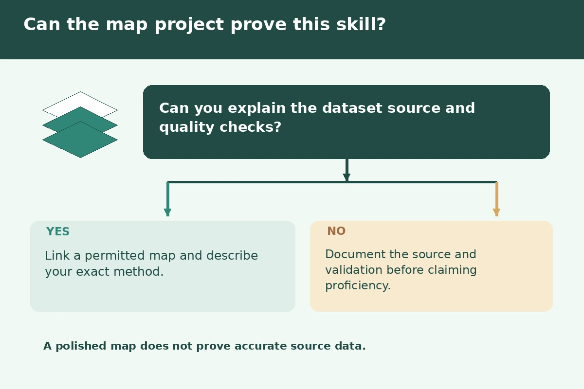
A final skills check has three questions: Could you explain the work without a script? Could a supervisor, instructor or authentic project artifact confirm it? Does the resume distinguish your decision from another person’s approval? If any answer is no, narrow the statement or omit it. Make the finished document easy to scan with familiar headings, consistent punctuation and working project links. Do not add an unsupported credential or promise that a particular keyword will pass an applicant tracking system.
How We Research and Check Job-Specific Resume Skills
On November 16, 2026, we reviewed these occupational sources: O*NET details GIS data layers, map preparation, quality checks and database maintenance. O*NET remote sensing tasks include geospatial accuracy review and merging source datasets. These are educational resume examples, not legal, clinical, engineering, insurance or procurement authorizations. For site policy, read our affiliate disclosure.
More Resume and Cover Letter Guides
A short skills list is acceptable, but a relevant map, dataset or data-quality bullet provides much stronger evidence.
Not by itself. Explain the analytical method, input data, quality checks and what conclusion the map does or does not support.
Yes when labeled as coursework or a student project and described truthfully, rather than represented as client employment.
Yes if you actually assigned, examined or transformed CRS information. Distinguish a display setting from a verified data transformation.
Only with appropriate permission. Use public or synthetic examples when employer records or sensitive locations are restricted.